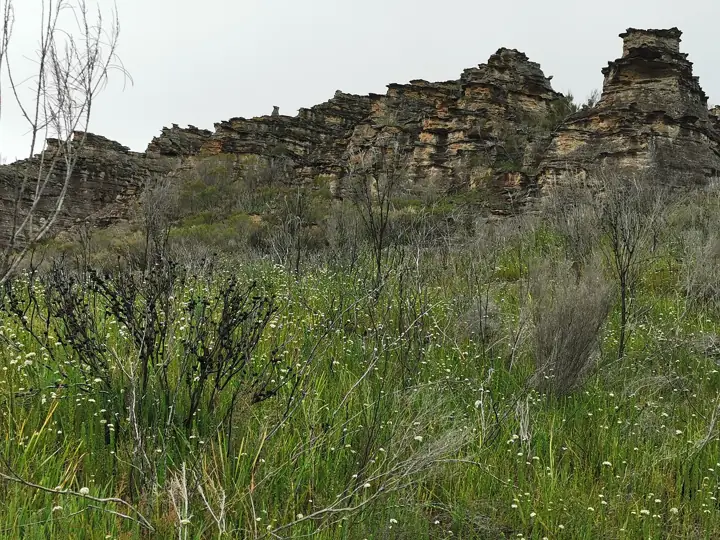
Ben Bullen Trail
A proper 4WD trail along the Great Dividing Range through Ben Bullen State Forest into Gardens of Stone National Park, ending near Baal Bone Gap.
- Time3hrs
- VehicleHigh-clearance 4WD only
- Nearest townLithgow
About this drive
Ben Bullen Trail follows the divide north of Lithgow, part of the Bicentennial National Trail. It passes sandstone cliffs and pagoda formations and links to the Baal Bone Gap picnic area.
Surface: 4WD trail: rock steps, ruts, steep pinches. Vehicle: High-clearance 4WD only.
Location map
Take this map offline
Phone reception drops out across most of the Mountains. Save the location before you leave town.
GPX opens in Gaia GPS, AllTrails, Organic Maps, Garmin and most navigation apps and shows your live position on the route with no signal. How to use offline maps.How to get there
From Lithgow, follow the Castlereagh Highway north towards Mudgee for about 30 km. The trail leaves the highway near Ben Bullen - follow NPWS signage and the map coordinates.
Parking: Baal Bone Gap picnic area.
Good to know
- Travel with a second vehicle and recovery gear.
- Limited mobile reception throughout.
- Impassable when wet.
Common questions
Where does Ben Bullen Trail start?
From Lithgow, follow the Castlereagh Highway north towards Mudgee for about 30 km. The trail leaves the highway near Ben Bullen - follow NPWS signage and the map coordinates. GPS: -33.21971, 150.02369.
Where do I park for Ben Bullen Trail?
Baal Bone Gap picnic area.
Can I take my dog to Ben Bullen Trail?
No. Dogs and other pets are not permitted in NSW national parks, including on leads or in vehicles.
Do I need a 4WD for Ben Bullen Trail?
High-clearance 4WD only. 4WD trail: rock steps, ruts, steep pinches.
Is there phone reception at Ben Bullen Trail?
Do not rely on it. Download the GPX file or save this page offline before you leave Lithgow.
Sources: NSW National Parks and Wildlife Service (distance, time, grade, coordinates). Last checked Friday 13 November 2026. Spotted something out of date? Tell us.
Photo: MargaretRDonald, CC BY-SA 4.0.
