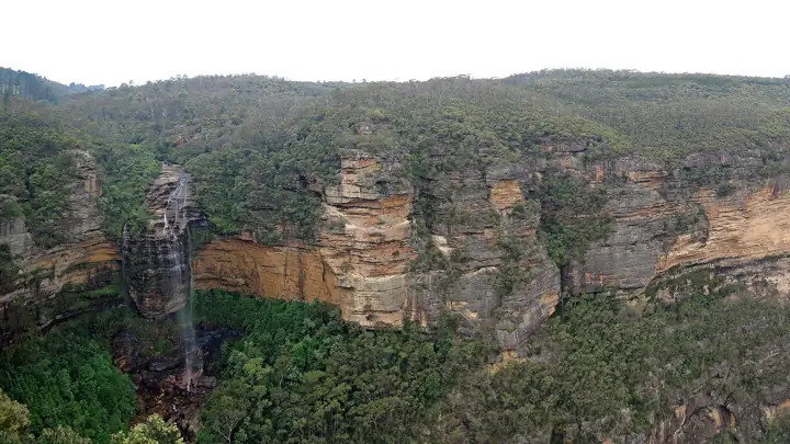
Overcliff-Undercliff Track
A loop that ducks under dripping overhangs and across hanging swamps between Wentworth Falls and the Conservation Hut.
- Distance3.5km loop
- Time1 - 2hrs
- DifficultyGrade 3 of 5
- Nearest townWentworth Falls
About this walk
The track contours along the cliff line between the Wentworth Falls picnic area and the Conservation Hut, passing under rock overhangs hung with ferns and out to a string of small lookouts.
Route map
Mapped length 2.2 km. Route line from OpenStreetMap; distance and grade in the summary are the official NPWS figures where available.
Take this map offline
Phone reception drops out across most of the Mountains. Save the route before you leave town.
GPX opens in Gaia GPS, AllTrails, Organic Maps, Garmin and most navigation apps and shows your live position on the route with no signal. How to use offline maps.How to get there
Start from Wentworth Falls picnic area (end of Falls Road) or the Conservation Hut (end of Fletcher Street), both off the Great Western Highway at Wentworth Falls.
Parking: NPWS carparks at both trailheads.
By train: Train to Wentworth Falls station, then about 2.5 km on foot.
Good to know
- Slippery after rain.
- The Conservation Hut cafe marks the halfway point.
Common questions
How long is Overcliff-Undercliff Track?
Overcliff-Undercliff Track is 3.5km loop and takes about 1 - 2hrs.
How hard is Overcliff-Undercliff Track?
It is rated Grade 3 on the Australian Walking Track Grading System: suitable for most ages and fitness levels, with some steps and short steep sections.
Where does Overcliff-Undercliff Track start?
Start from Wentworth Falls picnic area (end of Falls Road) or the Conservation Hut (end of Fletcher Street), both off the Great Western Highway at Wentworth Falls. GPS: -33.72521, 150.36876.
Where do I park for Overcliff-Undercliff Track?
NPWS carparks at both trailheads.
Can I take my dog to Overcliff-Undercliff Track?
No. Dogs and other pets are not permitted in NSW national parks, including on leads or in vehicles.
Is there phone reception at Overcliff-Undercliff Track?
Do not rely on it. Download the GPX file or save this page offline before you leave Wentworth Falls.
Sources: NSW National Parks and Wildlife Service (distance, time, grade, coordinates); OpenStreetMap contributors (route line). Last checked Friday 13 November 2026. Spotted something out of date? Tell us.
Photo: Robert Linsdell from St. Andrews, Canada, CC BY 2.0.
